

Tango
-
Posts
17 -
Joined
-
Last visited
Tango's Achievements
")
Newbie (1/14)
12
Reputation
-
B model?? Incidentally the longest flt is by a C-130 for over 36 hrs with 7 refuellings!
-
Yes it can be boring! In this one the crew flew Hi-Low-High profiles yet logged 13.31! Literally they juiced the fuel with their experience with piston engine flying!!!
-
13 hrs 31 min gruelling flight by one set of IAF crew, with over 1 hr plus endurance....kudos!
-
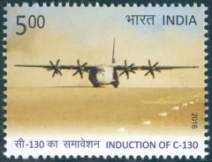
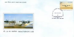
Indian Postal Dept Stamp on IAF C-130J released by the Hon'ble President of India and the Chief of the Air Staff on the eve of the IAF Day on 6 Oct 16. The stamp shows the Herc ready for take off from DBO, Ladakh, India the highest strip in the world after its first landing at 16614 feet......Yet another honour for the Herc!
-
-
The skidding of the Turkish Airlines Airbus-330 at Kathmandu runway in Mar 2015, rendered the Kathmandu runway and airport unusable since it obstructed the use of full length of the runway. With only about 4000’ of landing distance available at an elevation of about 4500’, the Indian Air Force Herc was called upon for the rescue mission! The IAF Herc airlifted the Air Inflatable Bags & the rescue team from Mumbai to Kathmandu and stopped just short of the Airbus to aid the rescue. ‘Teşekkür Ederim’ from Turkey!
-
Given the elevation of 1800' and temp in Sep-Oct, it translates to Temp Dev +10 to +20. This is by no means 'hot & high' in this part of the world. For J its about a take off roll of 4000' even with MTOW.
-
DBO (Daulat Beg Oldi) is a nondescript small campsite lying at the base of the Karakoram Pass of the Mighty Himalayas. The landscape is semi-arid with a brown desert like look in summers but characterized by a blinding whiteout in winters due to snow. Even with azure skies, the place looks fairly desolate with not even a blade of grass and bereft of any wild life whatsoever. To further embellish the picture, add the fact that this monochromatic play of nature is happening at an elevation of 16,614 ft AMSL, where winter temperatures drop to minus 50°Celsius and summers scorch at 20°Celsius (Temp Dev +38, in aviation parlance!). The Indian Air Force undertook the unprecedented task of landing a C-130J at DBO on 20 Aug 13, thereby creating a world record of the ‘Heaviest Aircraft to Land at the Highest in the World’! Preparations for the challenging landing were never-ending; with no TOLD data, high TAS considerations, nose wheel speed limits, max braking limits, bumpy unprepared sandy surface, emergency handling on ground, engine out considerations and no room for go-around, terrain clearances over the mighty Himalayas, etc, etc, etc!?! The mission was high risk and the remained shrouded by mystery till landing! The take-off even more hazardous! Prior to this, the Herc had only landed at El Alto Airport, La Paz, Bolivia at an elevation of 13,325 ft AMSL (assuming it to be the highest it will reach!). DBO was another 3500 feet above and at such altitude every feet and every added degree of temperature counts!! Perfect touchdown! No manufacturer guarantees any such acts of bravado, Lockheed Martin didn’t (but they are entitled to take post facto credits!!). The aircrew of Indian Air Force with very limited experience on the C-130 have put the Super Herc is on top of the world and it is not just an achievement for the crew that flew the mission but for the entire Herc community! Fly high, fly safe! Ready to roll! See video on - https://www.youtube.com/watch?v=w8HzOLE4fo8
-
Maiden Landing at Dharasu by c130 for flood relief operations in India
Tango replied to superherc's topic in C-130 General
By IAF! Lined up after offloading fuel (refuelling the helicopters) and with stranded tourists, ready for take off!! -
Lucky lucky crew, going thru this at night and being able to put down both ac safely! Years back (1992) two Antanov, AN-32s collided in India flying astern to each other at night. The ac in No 3 posn visually missed No 2 ahead and accelerated to catch up with No1 (mistaking him as No 2). Result-No 3 tore thru No 2 left wing with his rudder. No 2 went down vertically with no reaction, No 3 flew for a few minutes; lost directional control and finally crashed hitting the ground wings level. Terrible loss. Formation was visual then and cues of distance from ac ahead were taken from Primus WX radar! There were no traffic avoidance systems on ac then. But with the automation today and the additional SA available in the cockpit, such mishaps should be gone. Sadly they still happen. Lessons plenty for aviators....Fly safe!
-
Maiden Landing at Dharasu by c130 for flood relief operations in India
Tango replied to superherc's topic in C-130 General
The landing at Dharasu was challenging given the fact that the crew had no exposure to the area and planned everything off maps in less than 24 hrs. The airfield (length 3200') is tucked in high hills (8000'-12500') and at an elevation of 3000' next to the river bed. The shoulders had high bushes that had to be cut overnight. The landing was done almost blind when the visibility was just about 1 km using EOIR and copy book CRM! That means the crew descended IMC!! Furthermore, there was no scope of a go-around as there is a high hill feature in the landing direction. The daring landing was a great morale booster for the relief ops....!